
Dubai Unveils Unified Visual Identity System for Enhanced Urban Navigation
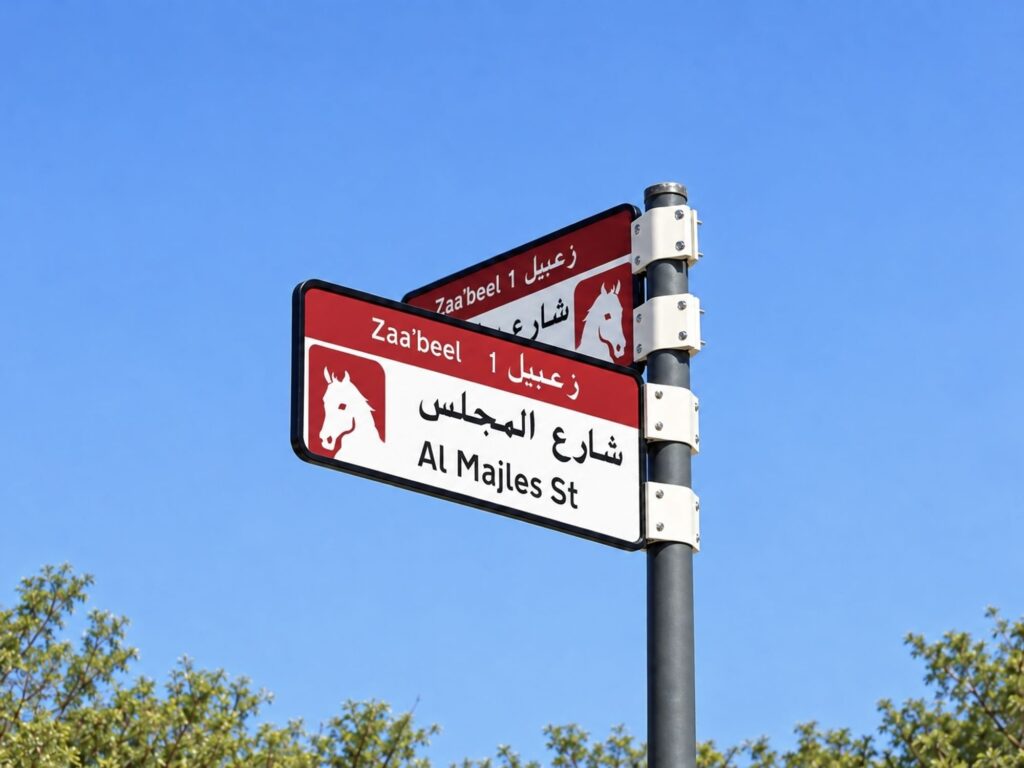
The Supreme Committee for Urban Planning, in partnership with the Roads and Transport Authority and Dubai Municipality, has introduced a sophisticated new addressing system featuring distinctive visual identities tailored to each of Dubai's diverse neighbourhoods.
Dubai has embarked upon a transformative urban initiative to enhance the clarity and aesthetic coherence of its addressing infrastructure. The Supreme Committee for Urban Planning, working in close coordination with Dubai’s Roads and Transport Authority and Dubai Municipality, has unveiled a new visual identity system that promises to elevate both navigation and civic design across the emirate.
The comprehensive initiative encompasses the installation and replacement of area identification signage, internal street nomenclature, and residential numbering plates, each designed with unified aesthetics that authentically reflect the geographic and architectural character of their respective locations. Developed in consultation with specialist wayfinding and addressing design consultants, the system represents a sophisticated fusion of practical functionality with visual refinement.
This addressing framework transcends conventional wayfinding purposes, positioning itself as an integral component of Dubai’s urban aesthetic identity. By enhancing street environments, residential precincts, and commercial districts, the initiative acknowledges how thoughtful design can celebrate the distinctive characteristics that distinguish communities throughout the emirate.
The implementation strategy is comprehensive in scope yet measured in execution. The phased programme will encompass 186 distinct areas distributed across 19 sectors, commencing in the fourth quarter of 2026 and continuing through 2030. The inaugural phase will see the installation and replacement of more than 2,000 signs across five pioneering areas: Za’abeel 1, Za’abeel 2, Nad Al Sheba, Al Khawaneej 1, and Nazwa.
The visual identity employs five carefully selected colours, each chosen to resonate with the distinctive character and geographic features of Dubai’s varied neighbourhoods. Blue designates coastal proximity, whilst gold symbolises desert-characterised regions, reflecting the remarkable diversity of Dubai’s topographical and urban landscapes. This chromatic palette extends across all addressing components, from sectoral identification signage to individual property numbering.
Future enhancements will extend this unified identity to bus shelters, digital applications, and area mapping installations. Significantly, the introduction of QR code technology will provide residents and visitors with contextual information regarding sector and area designations, nomenclature significance, points of cultural and commercial interest, and location-specific content.
The Roads and Transport Authority, in coordination with Dubai Municipality, has established rigorous implementation criteria encompassing urban development momentum, residential density, area vitality, tourism significance, and existing addressing gaps. This evidence-based approach ensures that project rollout aligns harmoniously with broader urban development trajectories and community requirements.
House number plates will incorporate Makani property identifiers alongside corresponding QR codes, with chromatic schemes harmonised to reinforce visual integration and facilitate location identification for residents and visitors alike.
Source: WAM